

Top Local Hiking Trails
Ringwood is home to over 100 miles of hiking and mountain biking trails that draw visitors from across the tri-state area. Whether you are chasing a summit view or looking for a quiet afternoon on the trail, we have something for everyone. Here are a few of our local favorites. Let us know what we missed.
You should ALWAYS have a map when hiking! The NYNJ Trail Conference has great digital versions of their maps with GPS available through the Avenza app on your phone or you can order the paper maps.
A map showing the trail locations and level of difficulty can be found below.
Check out the Ringwood Democratic Organization facebook group for information on future hiking meet ups.
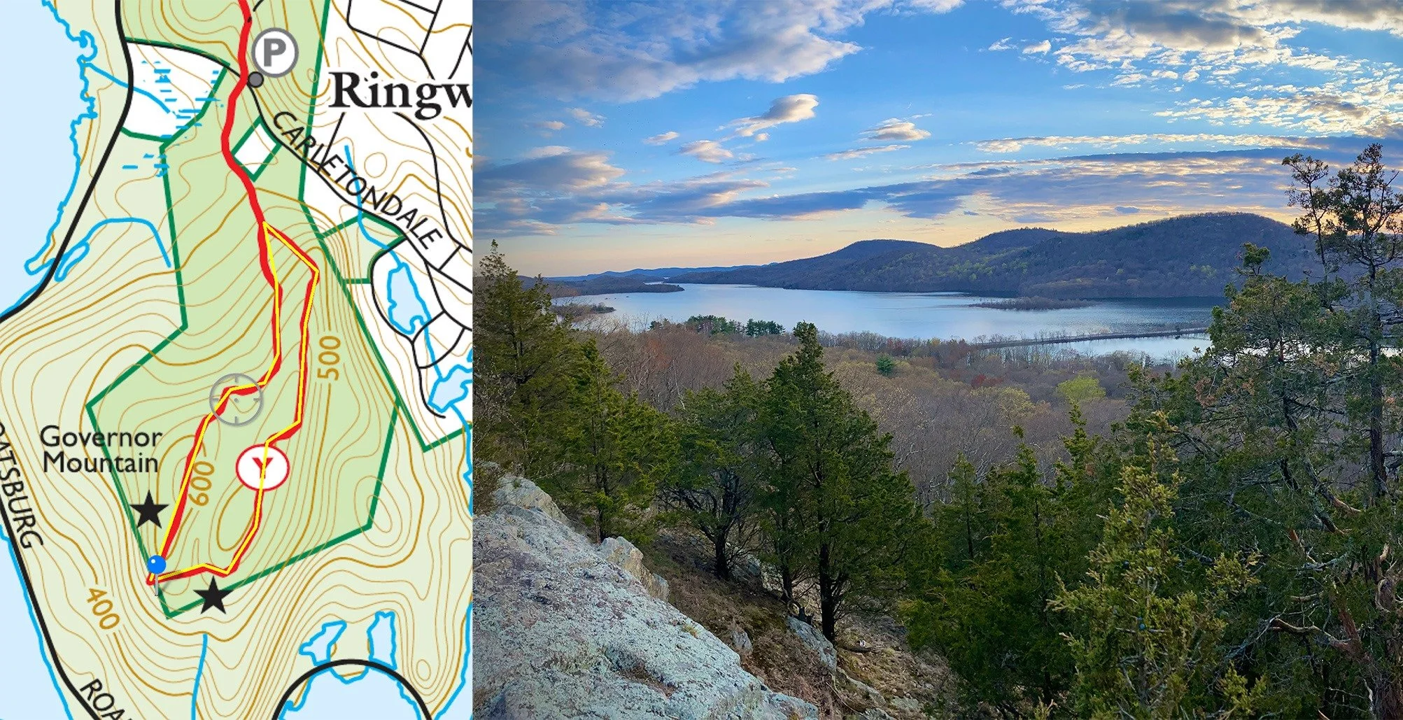
Governor's Mountain (2 miles roundtrip) - One of the best hikes in Ringwood! Park on Carletondale Rd across from Community Presbyterian Church - 130 ft elevation
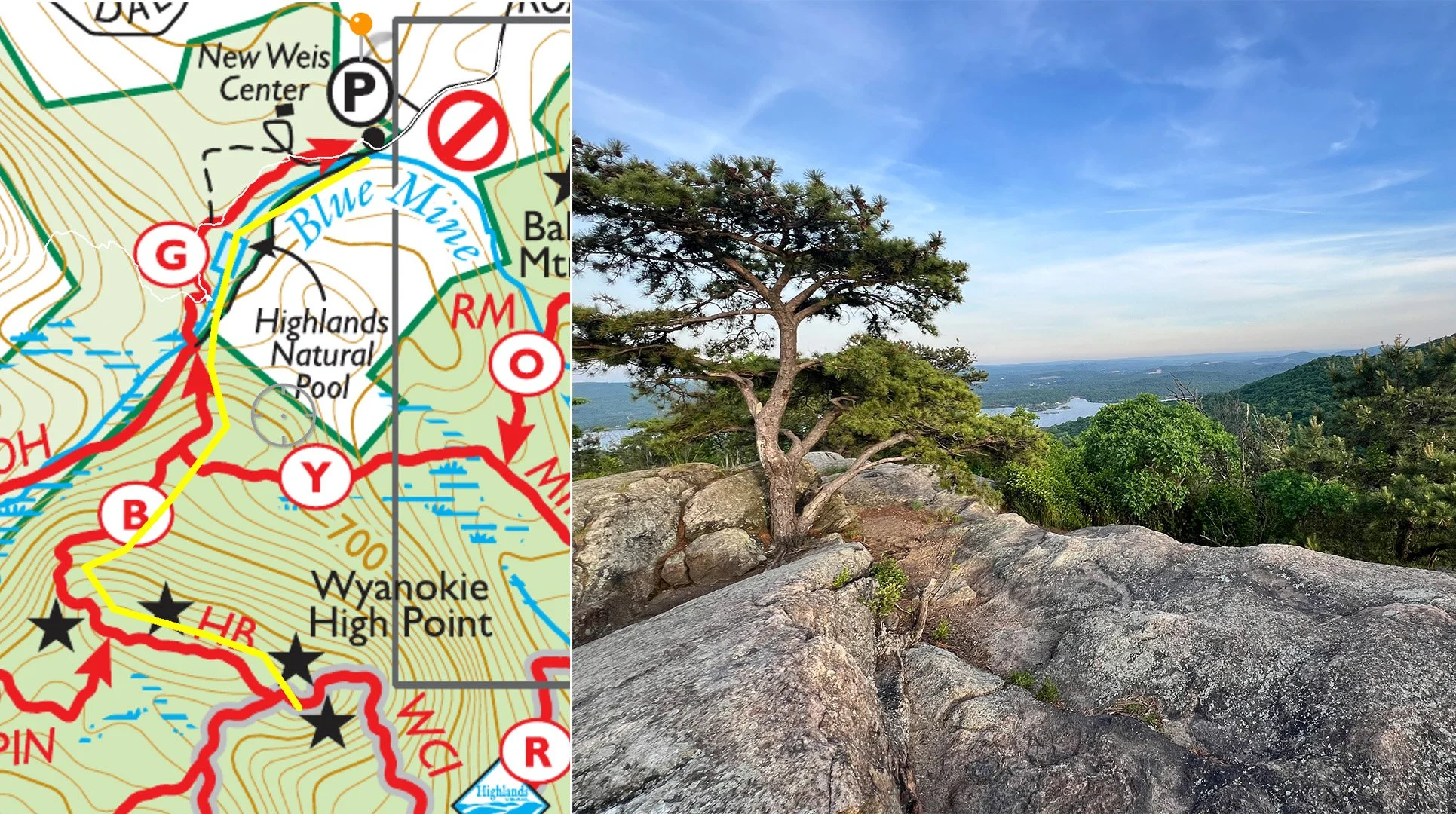
High Point at Norvin Green (2.25 miles) - Probably the best view in all of Ringwood! Use the Snake Den Rd parking lot - 800 ft elevation
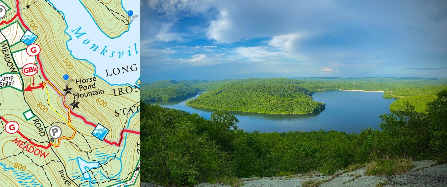
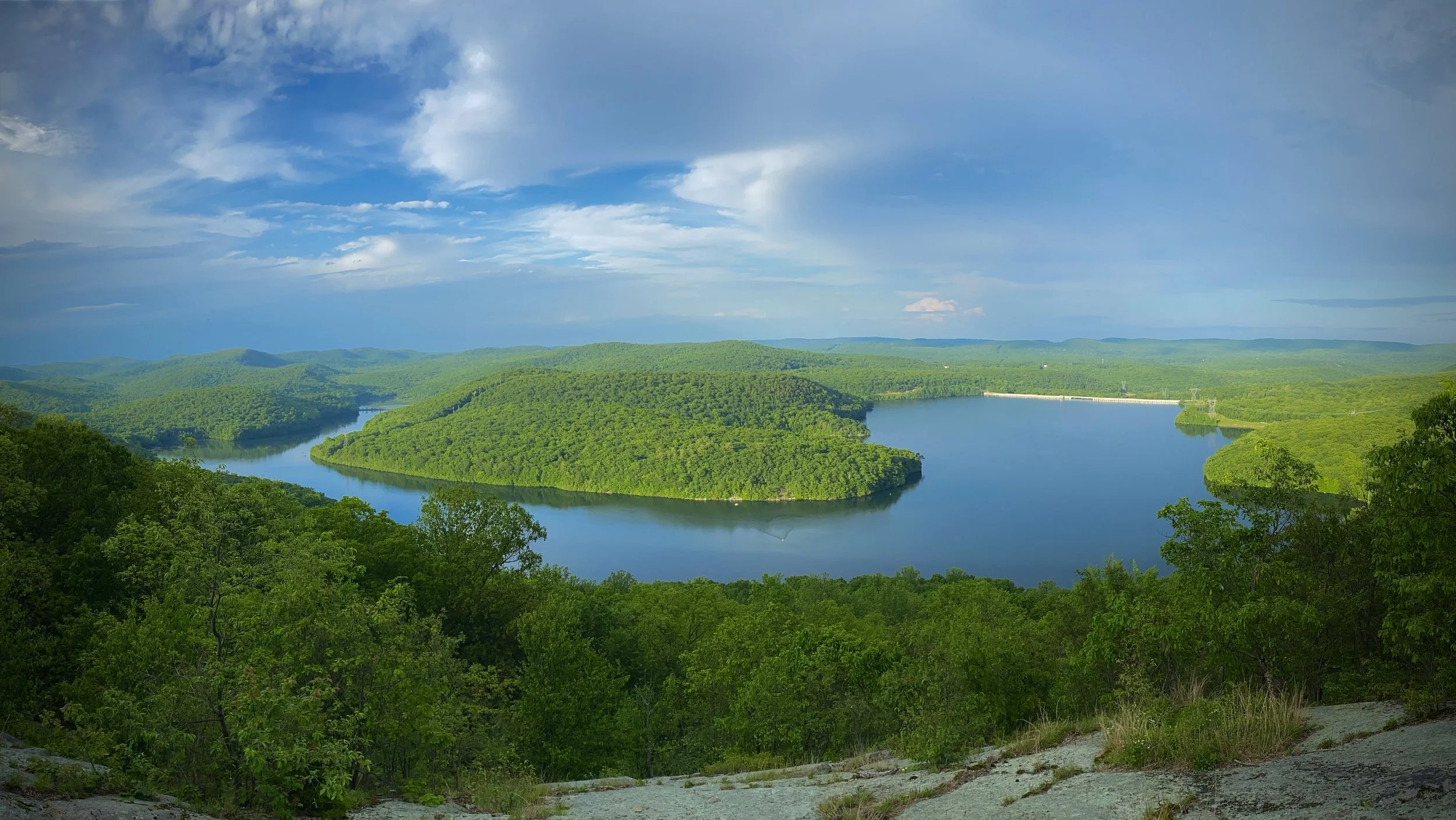
Horse Pond Mountain (1.2 miles) - One of our Nice hike with amazing view of Monksville Reservoir. Take Greenwood Lake Tpke to Burnt Meadow Rd for parking - 200 ft elevation
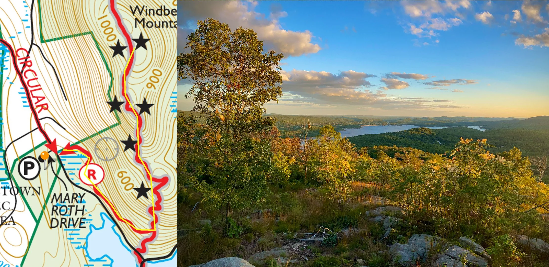
Windbeam Mountain (3-5 miles) - The harder the hike the better the view (usually) and this one doesn't disappoint! Numerous viewpoints with great views and prickly pear cactus near the top. 800 ft of elevation
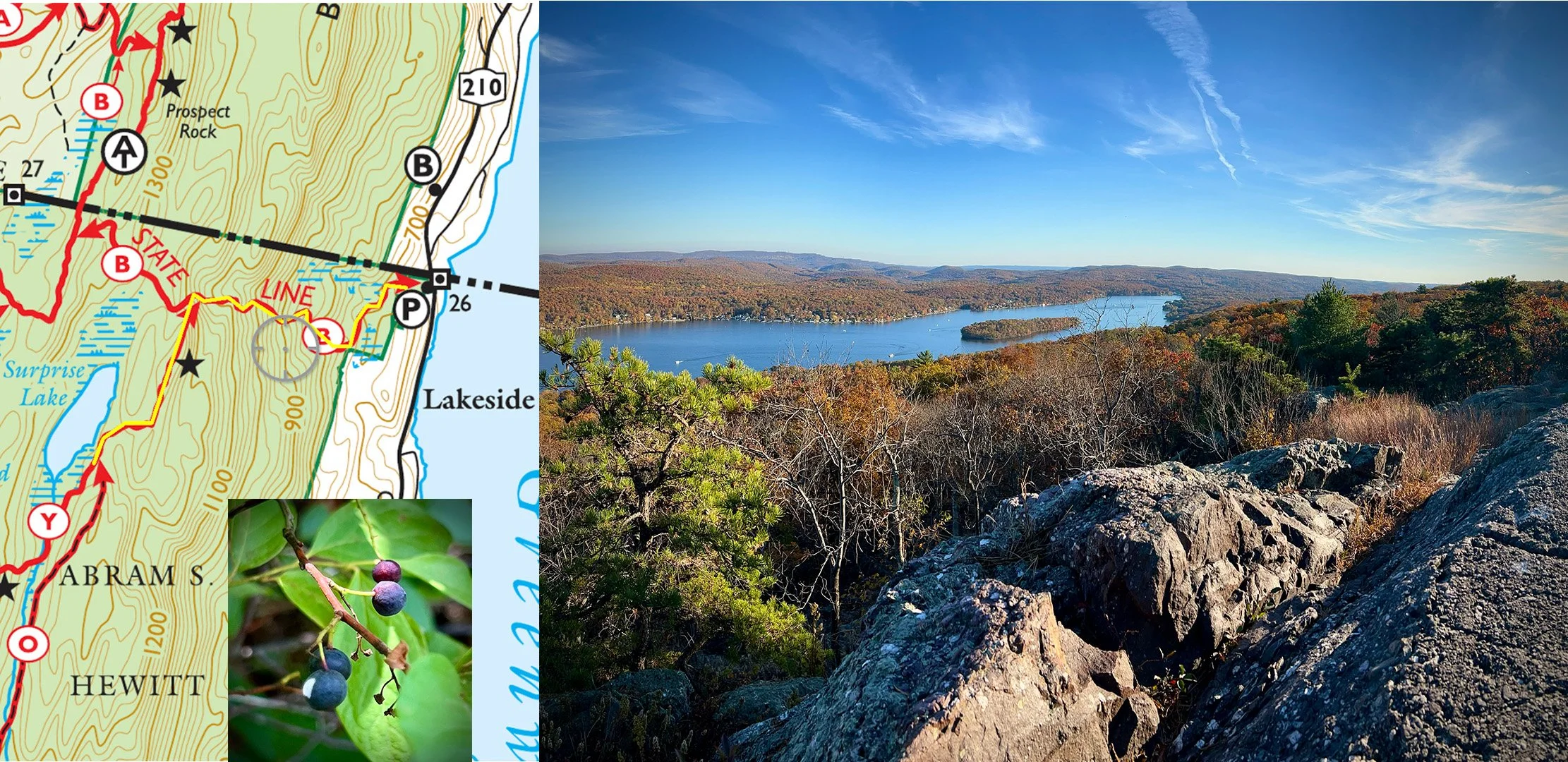
State Line Trail (3 miles) - It's not easy, but the view of Greenwood Lake is amazing! Surprise Lake is right past the peak and surrounded by delicious wild blueberries at the end of June/early July. You can also check out the Appalachian Trail. Parking is across the street from the Greenwood Lake Marina - 1000 ft incline
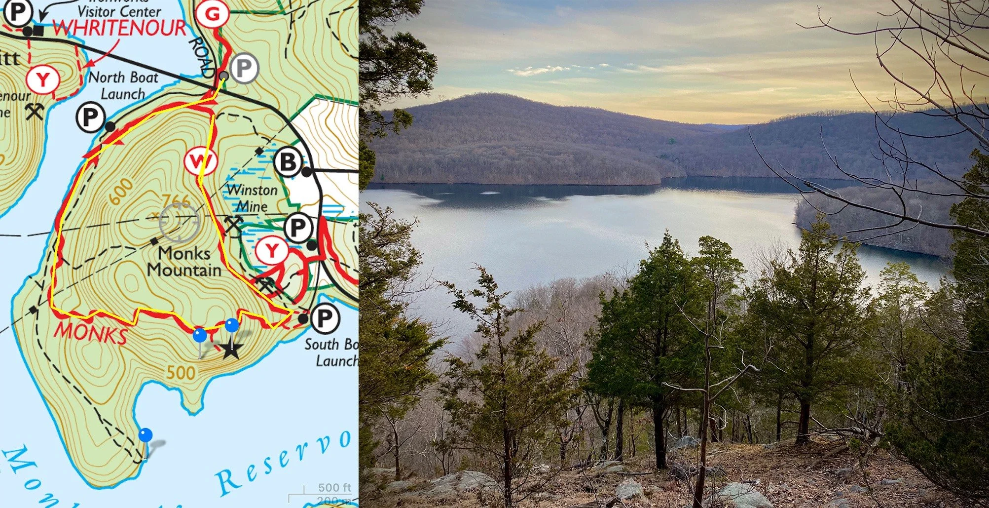
Monks Mountain (0.3 miles) - Not much time to exercise? This is a great quick burner with a nice view, prickly pear cactus and it's kid friendly - 240 ft elevation
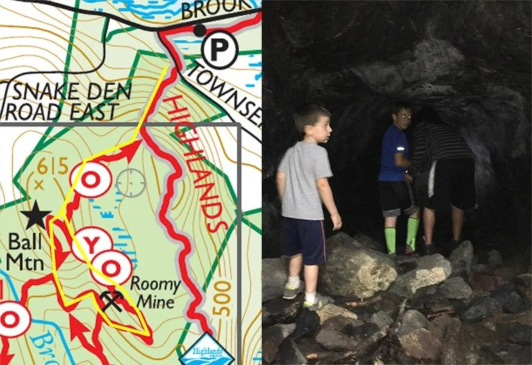
Roomy Mine (1.6 miles) - Crawl through the tunnel to enter this 100 feet long, pitch black cave! Bring a flashlight and it's only open May-October to avoid disturbing the bats 🦇 Park on Townsend Rd - little elevation
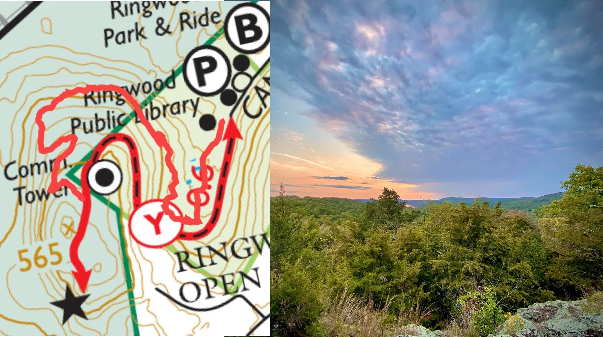
Library Trail (1.25 miles) Big thanks to Thomas Conway for this new trail. Park at the Ringwood Library and take the road path to the left of the playground. Once past the cell tower, look for the new trail extension on the right which makes it a fun circuit. (Keep an eye out for the new Fairy Trail addition coming soon) - 300 ft elevation
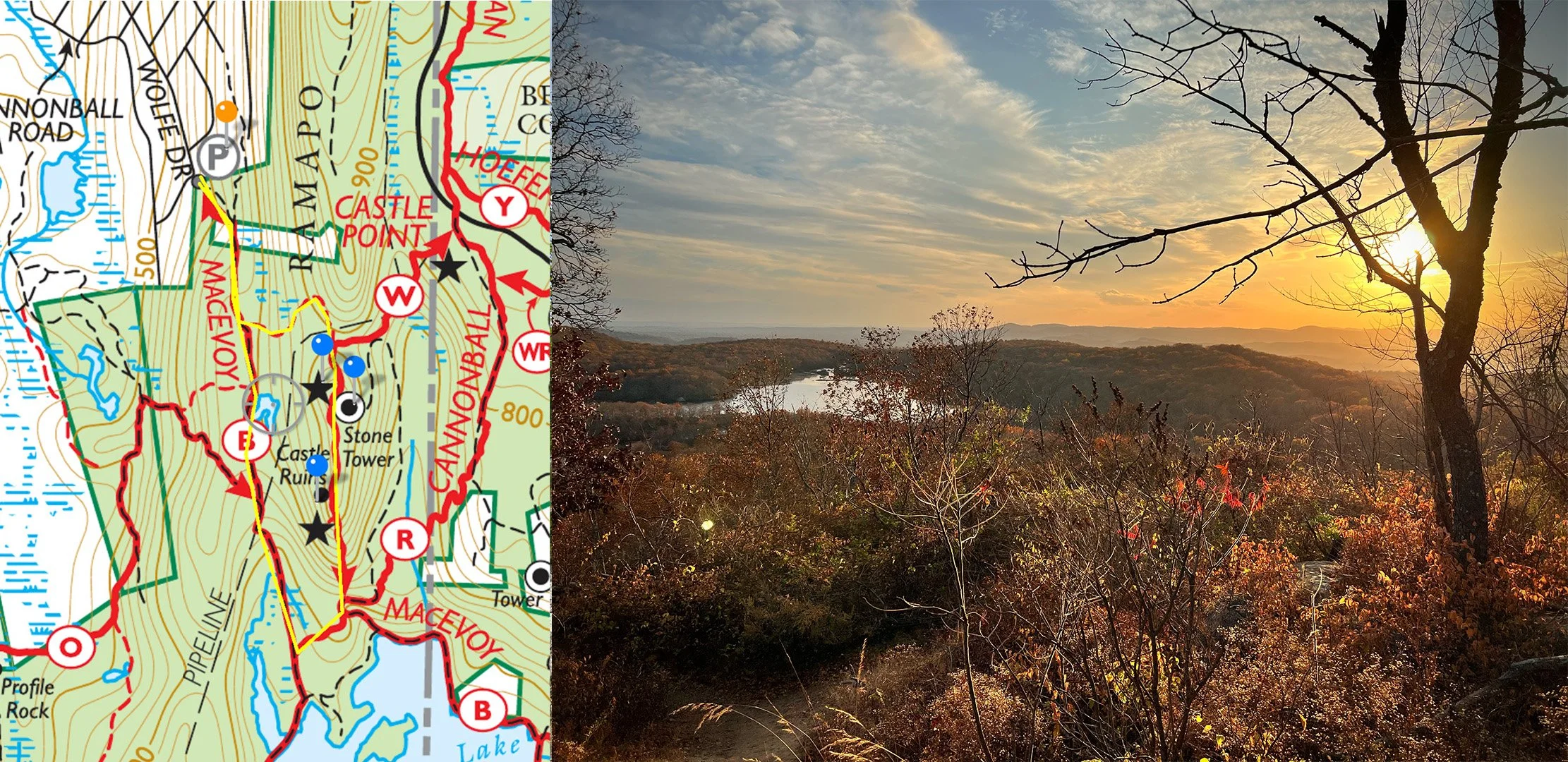
Castle Ruins - (1.5 miles) Fun easy hike with a stone tower, abandoned castle and great view! Park at the top of Skyline Drive or at the end of Wolfe Drive in Wanaque. 300 ft elevation
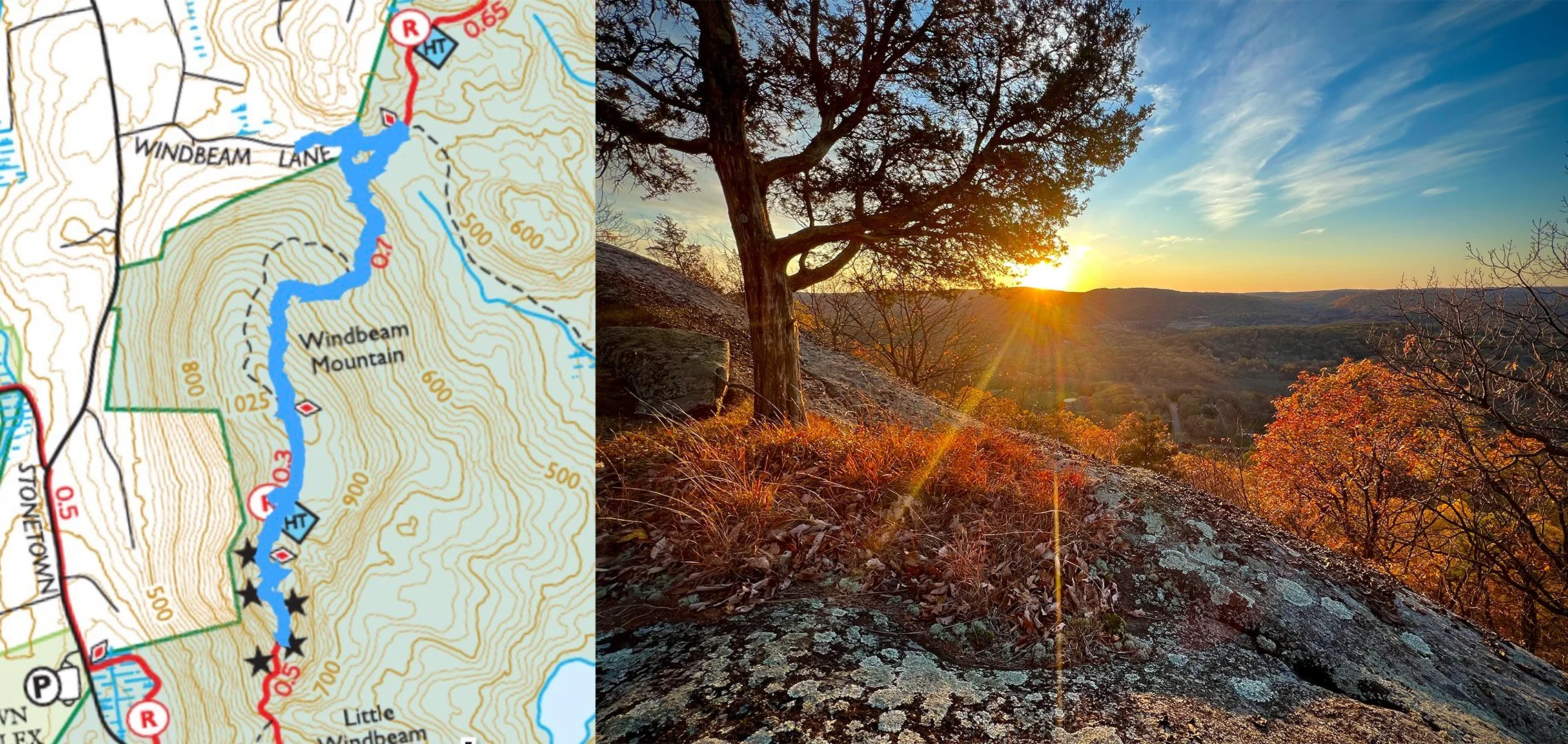
Windbeam North - (2 miles) Here's a different way to get to the top of Windbeam Mountain. Park at the end of Windbeam Lane and take dirt road to trail (around fence) - 600 ft elevation
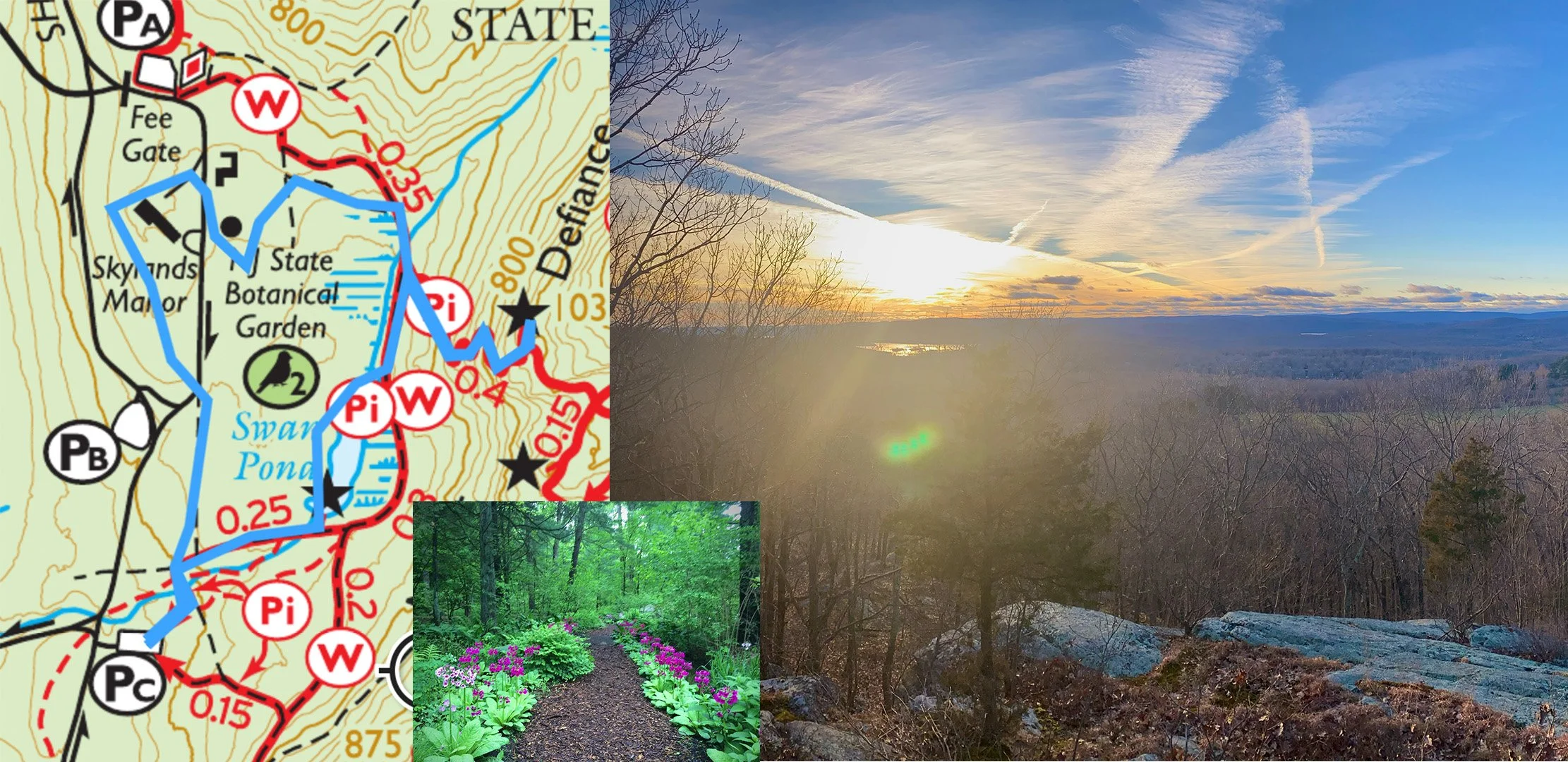
Mount Defiance - A great beginner hike with kids. Park at Parking Lot B by Skylands Manor and walk through the shade garden to the base of the mountain.
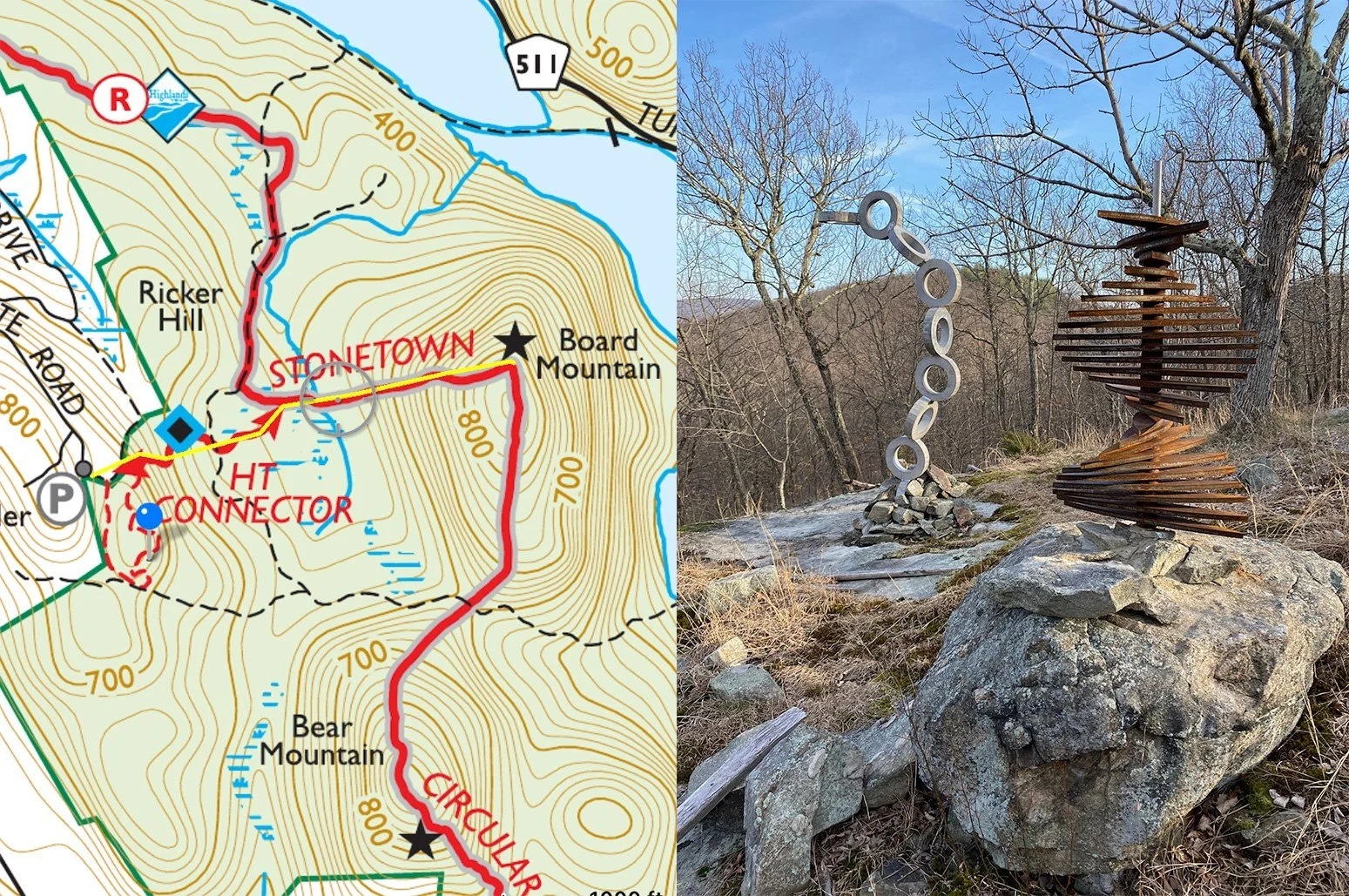
Sculpture Trail (1.5 miles ) - Short, easy hike through sculpture or add the hike to Board Mountain for a great view of the Monksville Dam. Park at the end of White Rd - 600 ft elevation
Warm Puppy Rock (1.75 miles roundtrip)- Park at Parking lot C in Ringwood State Park near NJBG - 250 ft elevation
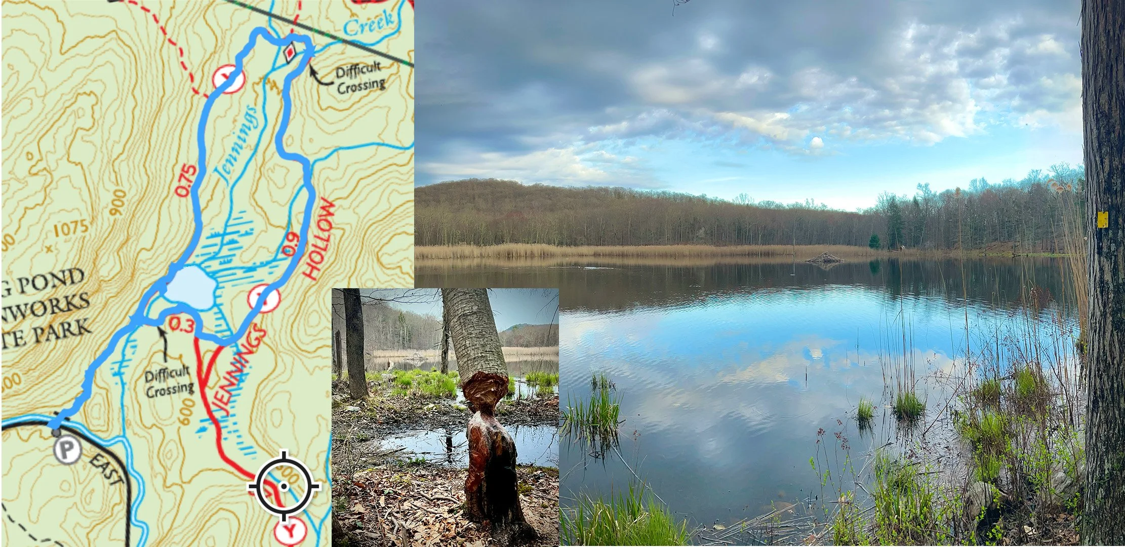
Jennings Creek - (1-2.5 miles) Fun, easy hike down to a secluded lake filled with beavers and birds. You'll see some burnt areas from the 2024 wildfire. Parking is on East Shore Rd in West Milford.
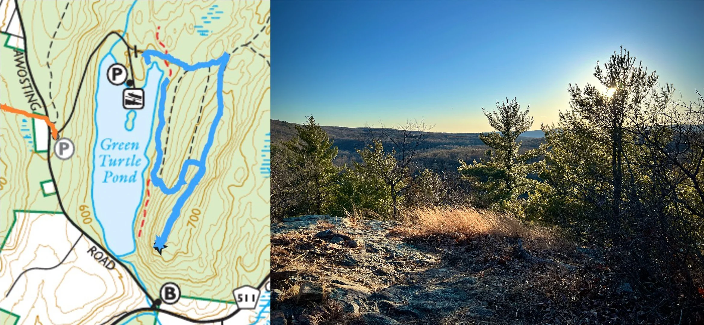
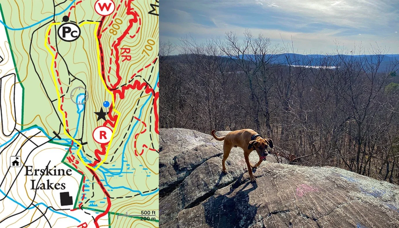
Green Pond - (1.6 miles) Relatively easy hike with nice view and walk past lake. Park down the access road off Awosting Rd.
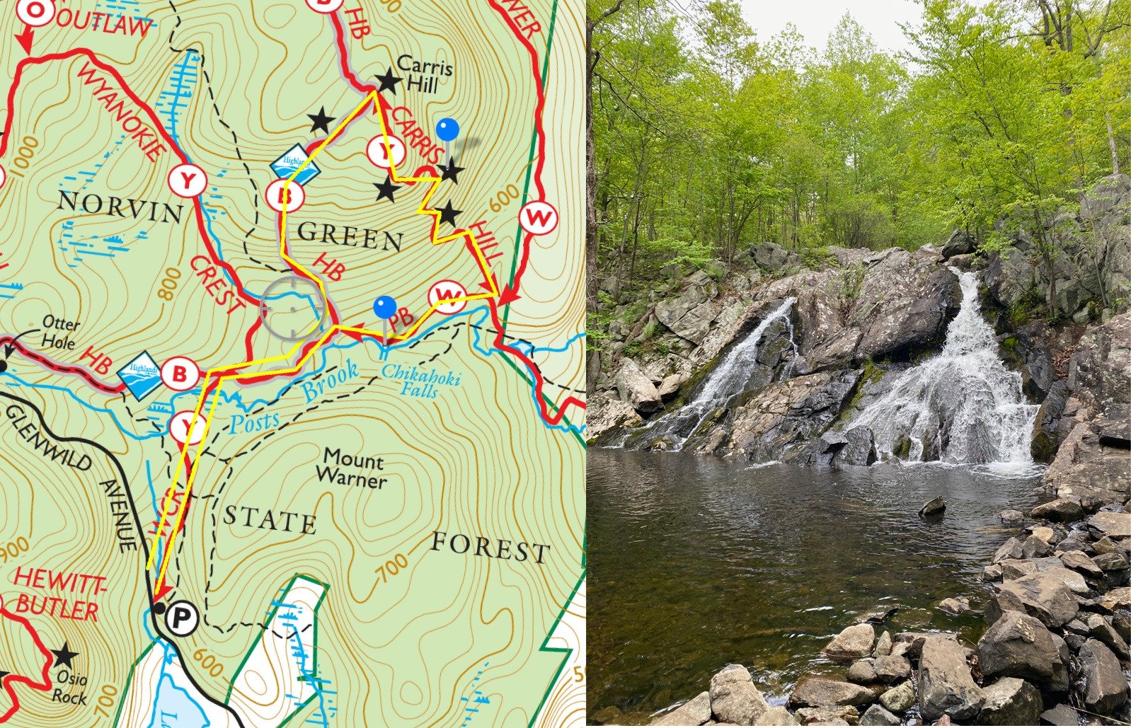
Carris Hill Hike - (2.8 miles) Great long hike with a waterfall and one of the best views around. You can park on Glenwild Ave in Bloomingdale or the end of Doty Rd in Haskell.
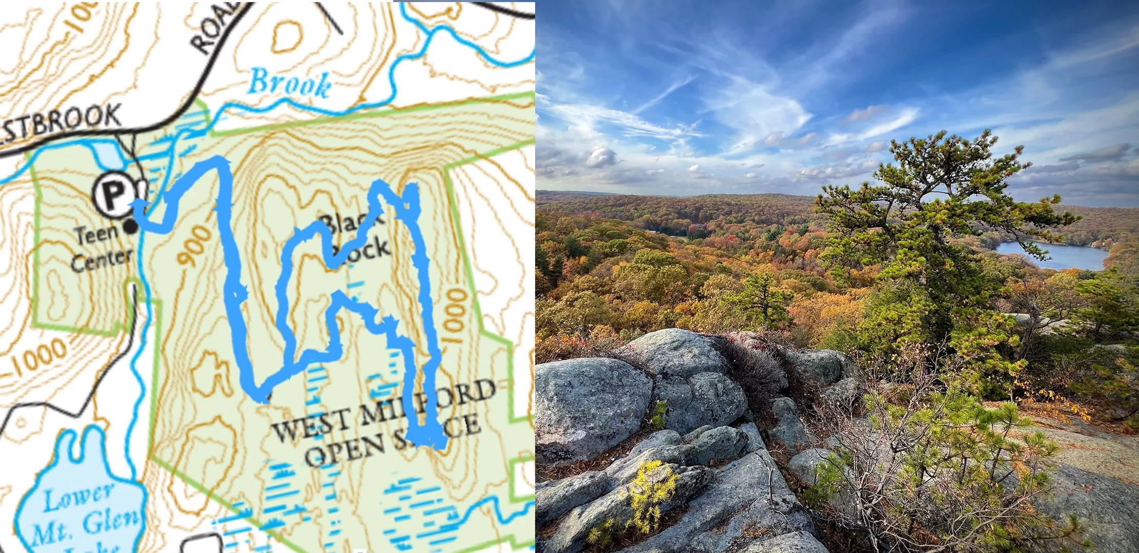
Black Rock (2-3 miles) - Really nice view from this West Milford hike, but the trail hasn't been blazed yet. The peak is where it says "Black Rock" and you can make a longer circuit but there's no other view or just come back the way you went. Park at the WM Teen Center on Westbrook Rd.
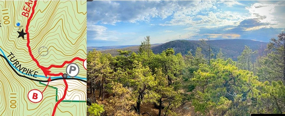
Bearfort Ridge North (1 mile) - starts with a nice river and an AMAZING Rhododendron forest that blooms in May. The view is half a mile from the parking on Greenwood Lake Tpke in West Milford
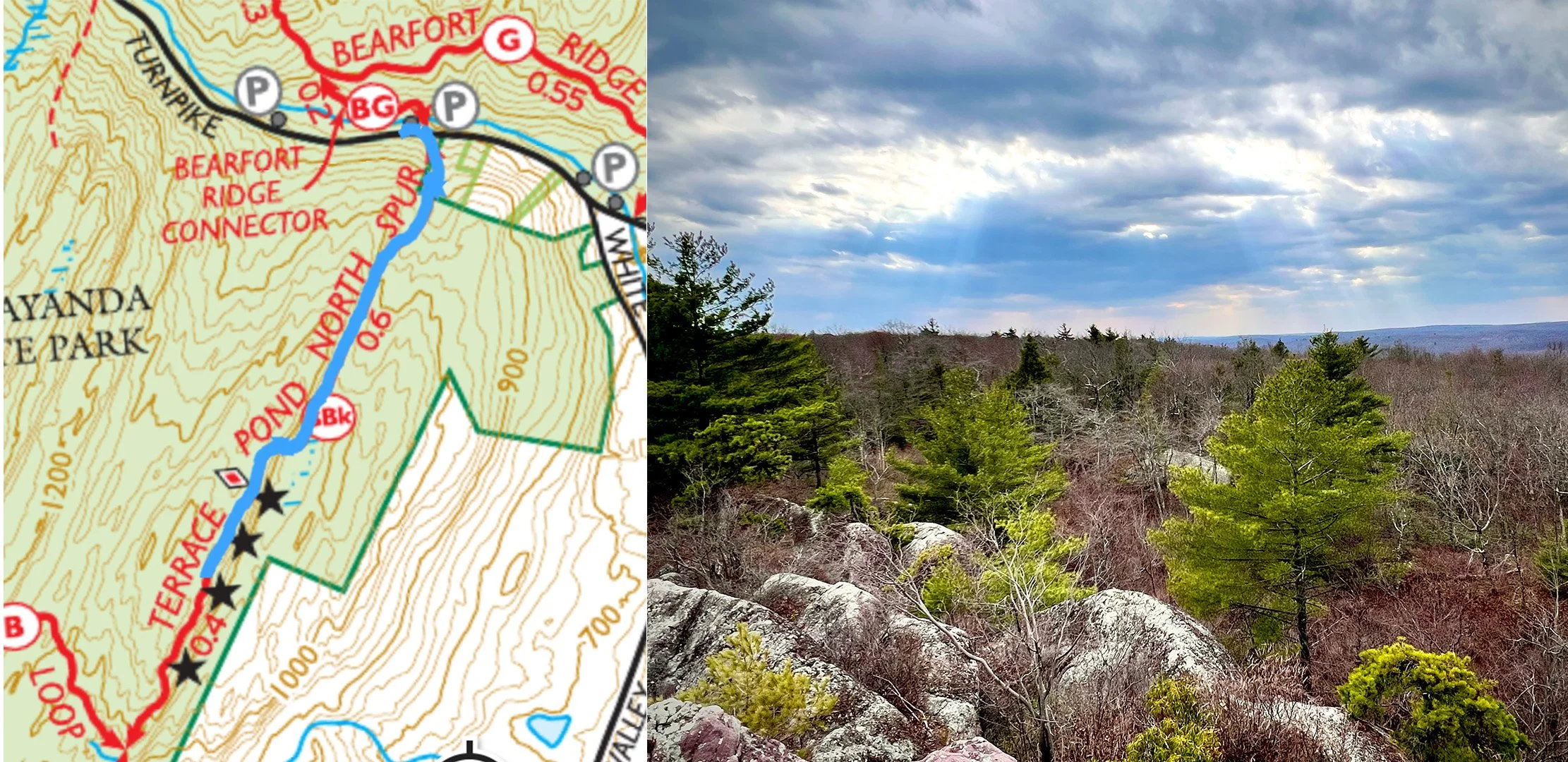
Bearfort Ridge South (1-2 miles) - Great view of West Milford, but busy area to park on Greenwood Lake Tpke.
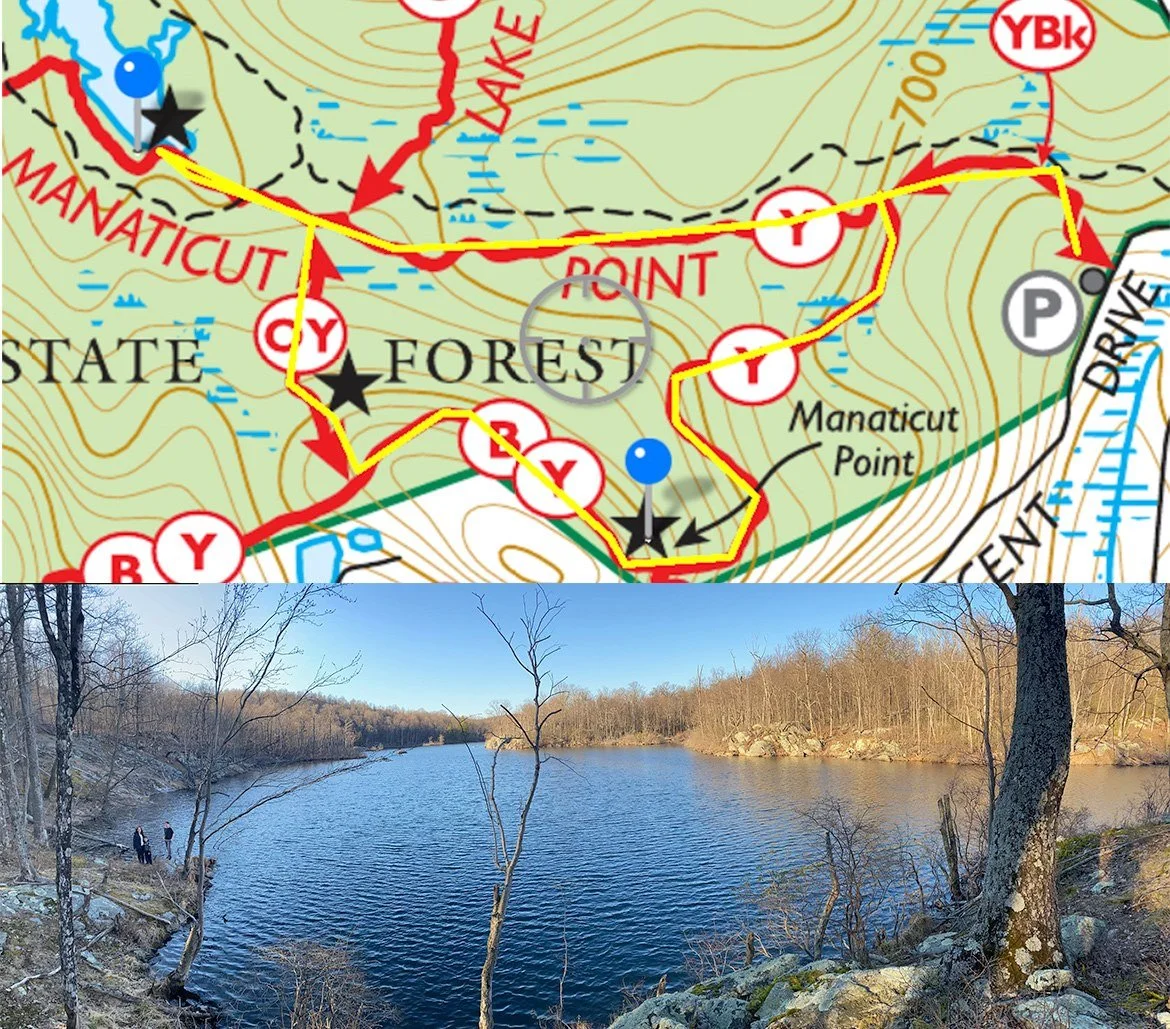
Manaticut Spur (1.7 miles) - Great circuit hike with views and a lake - Parking is on Crescent Drive in Stonetown
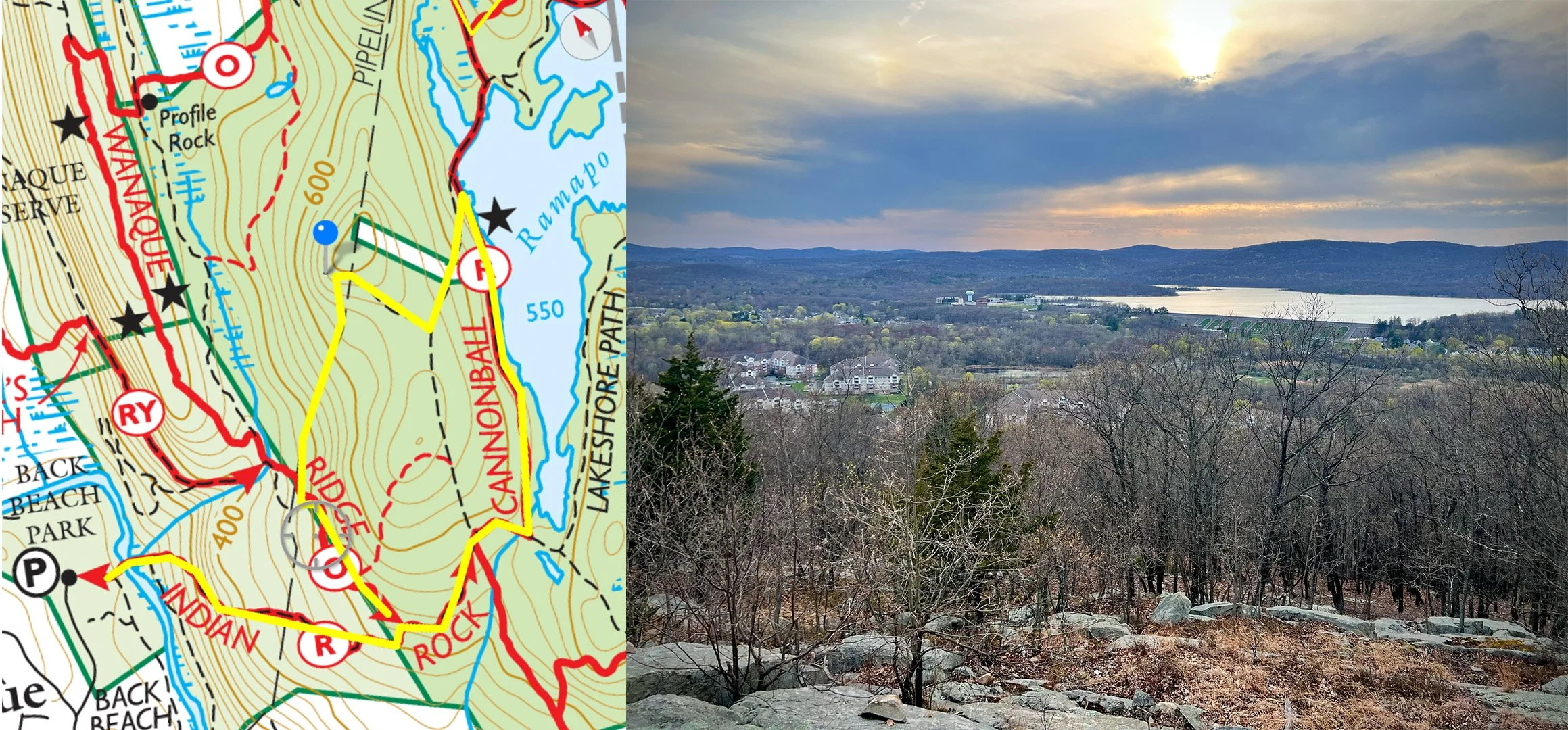
Wanaque Ridge Hike - (1-3 miles) Good hike that can include Ramapo Lake or just a nice view. Park at Back Beach in Haskell
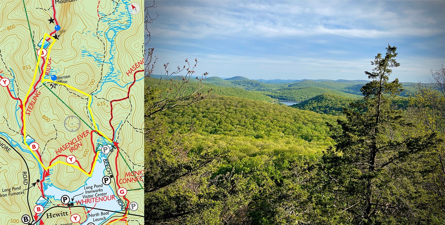
Hasenclever Trail - (1-3 miles) Nice view and you can check out the LongPond Furnace. Park at the end of Beech Road or at the Long Pond Visitor Center
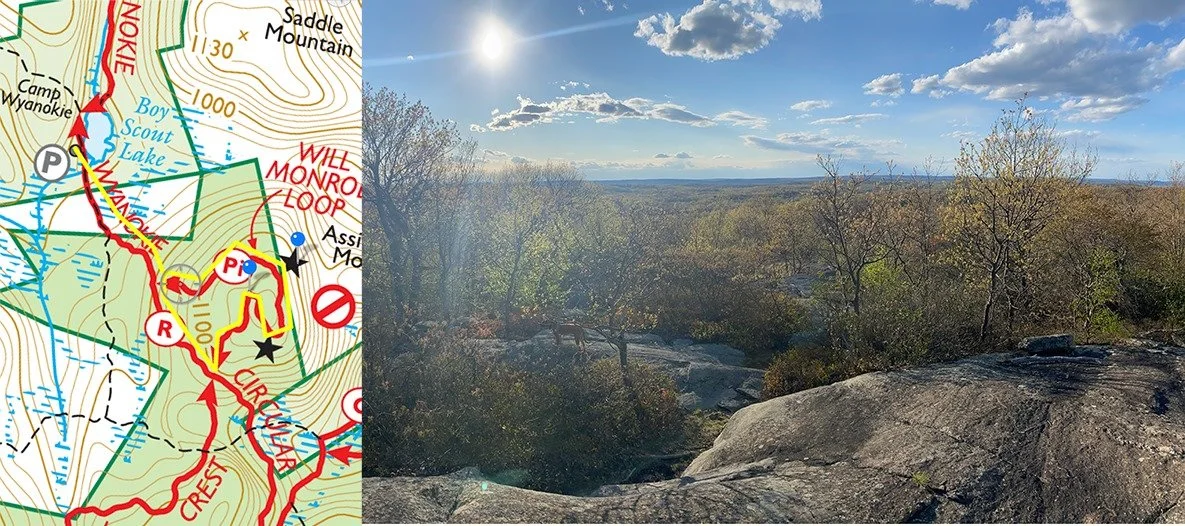
Assiniwikam Mountain (2 miles) - Park at the end of Snake Den Road (West) in West Milford.